Virginia Beach walking and biking trails with distances, trailheads and parking: First Landing's 20 miles, Foxfire Trail, Stumpy Lake and the VB Trail.
Last checked Oct. 19, 2026. Sources: Virginia Beach Parks and Recreation’s bikeways and trails page and park pages, the Virginia Beach Trail project, First Landing State Park and Back Bay National Wildlife Refuge.
Virginia Beach has more than 300 miles of bikeways and trails, the city says, including trails in more than 230 parks and natural areas, 27 miles of unpaved paths in two state parks and a federal wildlife refuge. These are the main walking and biking routes, with their distances, trailheads and parking. For the parks themselves, see our parks and trails guide.
Who to call
- Parks and Recreation active transportation: Steve Lambert, 757-385-4310
- First Landing State Park reservations and information: 800-933-7275
- Parks and Recreation: 757-385-1100
Current closure: Cape Henry Drive and the trail beside it are closed to through traffic between Kleen Street and Urchin Road for infrastructure work, with pedestrian detours in place, the city says.
The trails at a glance
| Trail | Length | Surface | Bikes? | Trailhead and parking |
|---|---|---|---|---|
| First Landing State Park (10 trails) | About 20 miles total | Paved and unpaved | Cape Henry and Live Oak trails only | Trail Center off Shore Drive; parking fee |
| Cape Henry Extension Trail (First Landing) | 1.6 miles | Unpaved | Ask the park | Off 64th Street |
| Sandridge Trail, False Cape State Park | 6.2 miles | Unpaved | Ask the park | Reached through Back Bay National Wildlife Refuge |
| Foxfire Trail | 0.91 mile | Paved, ADA compliant | Yes | West Neck Creek Natural Area, 2249 N. Landing Road; street parking near 2470 Esplanade Drive |
| Three Oaks Path | 0.33 mile | Paved, 10 feet wide | Yes | Three Oaks Elementary School, 2201 Elsen Green Ave. |
| Stumpy Lake Natural Area | 1.65 miles | Soft | Shared use | 4797 Indian River Road; 12 car spaces |
| Virginia Beach Trail (built section) | 1.5 miles | Paved | Yes | Norfolk Avenue between Birdneck Road and Pacific Avenue |
| Pleasure House Point Natural Area | Several short trails | Soft | No | Brock Center lot, 3663 Marlin Bay Drive |
First Landing State Park
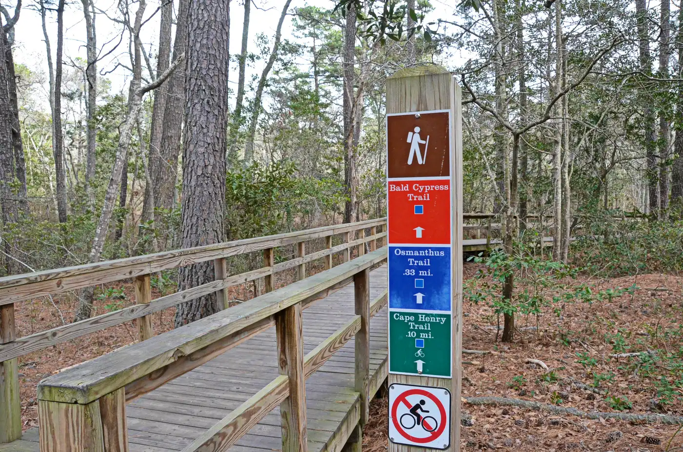
Virginia’s most visited state park has about 20 miles of trails across 10 routes, including bike and fitness trails, through bald cypress swamps, lagoons and maritime forest, the park says. Bikes are allowed only on the Cape Henry and Live Oak trails. The Cape Henry Trail is universally accessible from Kendall to 64th Street. Park hours are 7 a.m. to dusk; the Trail Center, with exhibits and restrooms, is open 8 a.m. to 4 p.m. To reach the trails, turn right off Shore Drive at the light for the Trail Center and picnic area. Weekends are very busy, and the park turns cars away once its lots are full.
The 1.6-mile Cape Henry Extension Trail off 64th Street runs past Lake Susan Constant and through salt marsh with views of Linkhorn Bay and nesting osprey, per the city’s Raptor Trail page.
City greenways
Foxfire Trail. A paved, ADA-compliant path on a former rail line, about 0.91 mile, from the Municipal Center area to the Foxfire and Seaboard neighborhoods. A pedestrian bridge crosses West Neck Creek, high enough for kayaks to pass under. Park at West Neck Creek Natural Area, 2249 N. Landing Road, or on the street near Foxfire Park, 2470 Esplanade Drive. It links to paths along Princess Anne Road and Nimmo Parkway, per Parks and Recreation.
Three Oaks Path. A 0.33-mile, 10-foot-wide paved greenway that opened June 2, 2025, linking Three Oaks Elementary School with the Three Oaks, Sherwood Lakes and Highgate Greens neighborhoods and the Red Mill shopping area. Park at the school.
Virginia Beach Trail. The city’s top trail priority is a 12-mile, 14-foot-wide paved path on the old Norfolk Southern right-of-way from the Newtown Road light-rail hub through Town Center to the Oceanfront. Today you can ride the finished 1.5 miles on the north side of Norfolk Avenue, Birdneck Road to Pacific Avenue. Phase 1 (3.2 miles, Newtown Road to Constitution Drive, including a bridge over Independence Boulevard) is in design, and Phase 4 (2.8 miles, South Birdneck Road to London Bridge Road) is funded, with construction expected in fiscal years 2031 and 2032, the city says.
Park loops
- Mount Trashmore Park, 310 Edwin Drive: shared-use paths and a perimeter trail around Lake Trashmore with 10 outdoor fitness stations. The South Boulevard parking lot has closed permanently for a stormwater project.
- Stumpy Lake Natural Area, 4797 Indian River Road: 1.65 miles of soft trails in 970 acres of forest around a 278-acre lake, with an ADA overlook and kayak launch.
- Marshview Park, 141 Marshview Drive: 100 wooded acres on Lake Rudee near the Oceanfront with ADA-accessible asphalt trails, soft multi-use trails and a mountain bike trail system, open dawn to dusk.
- Pleasure House Point Natural Area, 3957 Marlin Bay Drive: trails through 118 acres of marsh and maritime forest on the Lynnhaven River, open dawn to dusk. No bikes; leashed dogs welcome.
- Great Neck Park, 2513 Shorehaven Drive: wooded paths in a 70-acre park on Lynnhaven Bay.
Back Bay and False Cape
Back Bay National Wildlife Refuge, south of Sandbridge, is open sunrise to sunset daily for hiking, biking and wildlife watching and charges an entrance fee, per the U.S. Fish and Wildlife Service. Beyond it, the 6.2-mile Sandridge Trail runs almost the length of False Cape State Park.
Riding rules
- Bikes may ride on any city sidewalk except at Town Center and the Oceanfront Resort Area.
- Drivers must give cyclists at least 3 feet when passing, under the Virginia Bicycle Safety Act.
- Bikes are banned on I-264 and other limited-access highways.
What this means for you
- For a long, shady ride, take the Cape Henry Trail at First Landing, and go early on weekends.
- For a short paved walk with a stroller, try the Foxfire Trail or the Mount Trashmore loop.
- Check the Cape Henry Drive closure before riding to 64th Street.
Related: dog-friendly Virginia Beach and getting around.
Frequently asked questions
Where can I bike at First Landing State Park?
Only on the Cape Henry and Live Oak trails. The park’s 10 trails total about 20 miles, and the Cape Henry Trail is universally accessible from Kendall to 64th Street. The park is open 7 a.m. to dusk and charges for parking.
How long is the Foxfire Trail in Virginia Beach?
About 0.91 mile, paved and ADA compliant, from the Municipal Center area to the Foxfire and Seaboard neighborhoods, with a pedestrian bridge over West Neck Creek. Park at West Neck Creek Natural Area, 2249 N. Landing Road, or on the street near Foxfire Park, 2470 Esplanade Drive.
What is the Virginia Beach Trail?
A planned 12-mile, 14-foot-wide paved path along the old Norfolk Southern rail line from Newtown Road to Town Center and the Oceanfront. The easternmost 1.5 miles already exist on the north side of Norfolk Avenue between Birdneck Road and Pacific Avenue.
Can I ride a bike on the sidewalk in Virginia Beach?
Yes, on any city sidewalk except at Town Center and in the Oceanfront Resort Area, under city ordinance.
Are bikes allowed at Pleasure House Point?
No. Bikes and motorized vehicles are not allowed in Pleasure House Point Natural Area; walkers and leashed dogs are welcome on its trails, open dawn to dusk.
Have your say